NOTICE AND DESCRIPTION OF SHELLFISH AREA CONDEMNATION
NUMBER 050-073, WARE AND TASKINAS CREEKS
VIGENTE A PARTIR DEL 15 DE AGOSTO DE 2020
De conformidad con el Título 28.2, Capítulo 8, §§ 28.2-803 a 28.2-808, § 32.1-20, y § 2.2-4002, B.16 del Código de Virginia.
1. The “Notice and Description of Shellfish Area Condemnation Number 050-073, Ware and Taskinas Creeks,” effective 15 August 2019, is cancelled effective 15 August 2020.
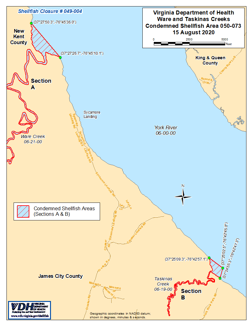
2. Condemned Shellfish Area Number 050-073, shown as Sections A and B, is established effective 15 August 2020. It shall be unlawful for any person, firm, or corporation to take shellfish from these areas for any purpose, except by permit granted by the Marine Resources Commission, as provided in § 28.2-810 of the Code of Virginia. The boundaries of these areas are shown on the map titled “Ware and Taskinas Creeks, Condemned Shellfish Area Number 050-073, 15 August 2020” which is part of this notice.
3. El Departamento de Salud recibirá, considerará y responderá a las peticiones de cualquier persona interesada en cualquier momento con respecto a la reconsideración o revisión de esta orden.
LÍMITES DEL ÁREA EXPROPIADA NÚMERO 050-073
A. The condemned area shall include that portion of the York River and all of Ware Creek and its tributaries lying upstream of a line drawn between latitude / longitude map coordinate (37°27'50.3",-76°45'36.0") and map coordinate (37°27'26.7",-76°45'10.1").
B. The condemned area shall include that portion of the York River and all of Taskinas Creek lying inland of a line drawn between latitude / longitude map coordinate (37°25'09.3",-76°42'57.1"), map coordinate (37°25'02.5",-76°42'45.0"), and map coordinate (37°24'55.3",-76°42'47.3").